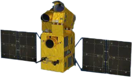
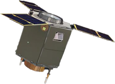
Remote Sensing Calibration
Emposat cooperated with Wuhan University and Ningxia Zhongwei City Government to be the world's first integrated calibration and authenticity test site for imaging remote sensing satellites and non-imaging altimetry satellites. We provided calibration and authenticity inspection services for optical, infrared, SAR and other remote sensing satellites.
Calibration Services
SAR Satellite Calibration Service
20  automatic angle reflectors
3  SAR multi-band active calibrators
support SAR satellite geometric radiation calibration and radiation quality evaluation
Optical Satellite Calibration and Inspection Service
25  reflective moving pointolite targets
support optical remote sensing satellite in-orbit absolute radiation calibration and accuracy verification
Laser Satellite Calibration and Inspection Service
1500  fixed laser signal receivers
500  mobile laser signal receiver equipments
support on-orbit geometric calibration and accuracy verification of satellite laser altimeter

Calibration Cases

The calibration site has provided calibration services for 10+ satellites, and has completed 70+ calibration experiments in total.

Type Data Remark
Satellite Azimuth transmitting antenna pattern file Provided by the satellite operators
SAR image Provided by the satellite operators(L1B level data)
Beam center elapsed equipment time Provided by the satellite operators
Equipment Azimuth transmitting antenna pattern file Calculated by the equipment supplier
Based on the above data, the azimuth beam pointing measurement can be completed.
SAR Beam Pointing Deviation Measurement
1. Test and verify the function and performance compliance of the multi-band SAR active calibrator equipment of the Zhongwei remote sensing satellite calibration field,
  focusing on the C-band remote sensing payload (5.4GHz±120MHz):
  ①Retransmission function: simulating standard point target,
  ②Receiving function: analyze the SAR azimuth to the emission pattern;
2. Measure the satellite’s azimuth to the antenna pattern.
Type Data Remark
Satellite Azimuth transmitting antenna pattern file Provided by the satellite operators
SAR image Provided by the satellite operators (L1B level data)
Azimuth transmitting antenna pattern file Provided by the equipment supplier (one for each equipment)
Equipment Equipment RCS Provided by the equipment supplier (three units set as one unit)
Based on the above data, the directional pattern of the load azimuth to the transmitting antenna and the absolute radiation calibration parameters can be settled.
SAR Radiation Calibration
1. Test and verify the function and performance compliance of the multi-band SAR active calibrator equipment of the Zhongwei remote sensing satellite calibration field,
  focusing on the C-band remote sensing payload (5.4GHz±120MHz):
  ①Retransmission function: simulating standard point target,
  ②Receiving function: analyze the SAR azimuth to the emission pattern;
2. Measure satellite's absolute radiometric calibration and other main radiation data.
Type Data Remark
Satellite Azimuth transmitting antenna pattern file Provided by the satellite operators
SAR image Provided by the satellite operators (precise processing afterwards)
Equipment Angle Reflector Point Coordinate Provided by the equipment supplier (one for each equipment)
Atmospheric Data at the time of Satellite Transit Provided by the equipment supplier (one site)
Satellites and equipment directly obtain data sheets after the experiment.
SAR Geometric Calibration
1. Test and verify the conformity of the functions and performance of the multi-band SAR active calibrator equipment of the Zhongwei remote sensing satellite calibration field,
  focusing on testing satellite payload: on-orbit geometric calibration function and performance;
2. Measure the main geometric parameters such as the on-orbit geometric calibration parameters of the satellite.
Type Data Remark
Satellite Panchromatic image Provided by the satellite operators
Multispectral band image Provided by the satellite operators (precise processing afterwards)
Equipment Pointolite specular reflectance Provided by the equipment supplier (one for each equipment)
Equipment RCS Provided by the equipment supplier (one for the entire site)
Satellites and equipment directly obtain data sheets after the experiment.
High Score Remote Sensing Payload Test
1. Test and verify the conformity of the functions and performance of the multi-band SAR active calibrator equipment of the Zhongwei remote sensing satellite calibration field,focusing on testing high score remote sensing payload (0.5m-4m):① MTF measurement function and performance; ②Absolute radiation calibration function and performance On-orbit geometric calibration function and performance;
2. Measure main radiation parameters such as on-orbit MTF of high-resolution remote sensing payloads (0.5m-4m), on-orbit absolute radiometric calibration parameters, etc.

Business Consulting

Please fill in your basic information and business requests, our software experts will reply to you within one working day.

{{nameTip?nameTip:''}}
{{phoneTip?phoneTip:''}}
{{mailTip?mailTip:''}}
{{businessTip?businessTip:''}}