INFRASTRUCTURE
Infrastructure
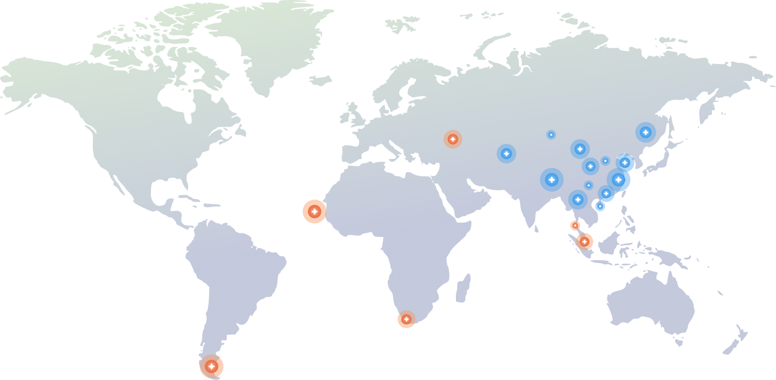
Global network layout
Aerospace Control Star is a leading enterprise in the field of domestic commercial space infrastructure construction and operation, as well as satellite tracking, operation and control services. It has established a global commercial space tracking and control network consisting of over 20 stations and more than 60 sets of equipment, and possesses the ability to provide tracking and control services and high-speed data reception for low, medium and high orbit satellites.

Global coverage

High-speed data transmission

System is complete

International layout
Southeast Asia, West Asia, Africa, South America

Domestic layout
Northeast Station, Northwest Station, Southern Station, Central Station, Mobile Station, Cooperation Station
Calibration Field
Tasks Executed
300
+
Missions
- Fixed site of about 300 mu (20 ha), with point-source targets and laser calibrators
- Three spaceborne-SAR active calibrators in a linear east–west layout at 1.3 km spacing
- Twenty automated corner reflectors in a grid: east–west spacing 1 km, 2 km, 3 km and 9 km; north–south spacing about 5 km
01
SAR Satellite Calibration and Verification System
Zhongwei Calibration Field: SAR Multi-band Active Calibrator
Supports scientific tasks including SAR radiometric calibration and radiometric performance assessment.
Unattended operation with remote monitoring and control.
Operating frequency:
- L-band: 1.26 GHz ± 100 MHz
- C-band: 5.4 GHz ± 120 MHz
- X-band: 9.6 GHz ± 600 MHz
- RCS accuracy: 0.2 dB
Zhongwei Calibration Field: Automated Corner Reflectors
Supports SAR geometric calibration, radiometric calibration, and quality/performance evaluation.
24/7 all-weather unattended operation.
- Corner reflector size: 1 m (right-angle side length)
- RCS accuracy: better than 0.2 dB
02
Optical Satellite Calibration and Verification System
Zhongwei Calibration Field: Reflective Mobile Point Light-Source Target
Supports in-orbit modulation transfer function (MTF) measurement for optical remote sensing sensors.
Supports in-orbit absolute radiometric calibration for optical remote sensing sensors.
- Supported sensor resolution range: 0.5–4 m
- Radiance intensity levels: 6–8
- In-orbit absolute radiometric calibration accuracy: better than 7% (radiance calibration)
- In-orbit MTF measurement accuracy: better than 10%
03
Laser Altimetry Satellite Calibration and Verification System
Zhongwei Calibration Field: Reflective Mobile Point Light-Source Target
Zhongwei Calibration Field: Spaceborne laser geometric calibration instrument.
Used for geometric calibration and accuracy verification of satellite laser altimetry payloads.
- Supports relative calibration of large-footprint LiDAR energy.
- Provides a calibration terminal for 1064 nm LiDAR systems.
- Effective quantization: 16-bit
Space Cloud
The Aerospace Cloud relies on the global ground station network and professional measurement and control service capabilities of Aerospace YuXing, and integrates the self-built and managed professional IDC data center resources to create an industry cloud platform specifically for the aerospace sector.
The platform can provide industry customers with one-stop cloud infrastructure services such as data storage, transmission, computing power scheduling, and security protection, helping aerospace enterprises significantly reduce data reception, storage, and computing costs, strengthening the data security bottom line, and fully releasing the core value of aerospace data.
Core Positioning
Aerospace domain cloud platform
- Platform Foundation: Relying on the global ground station network and telemetry control capabilities of Aerospace Control and Navigation
- Resource Integration: Integrating self-built and managed professional IDC resources
- Core Services: For the aerospace field, providing integrated infrastructure services including storage, transmission, computing, and security
Computing power and resources
Astronautical-grade computing infrastructure
- Self-built dedicated IDC campus of 24.98 mu (≈1.67 ha) with two data-hall buildings
- Peak compute of 4,000 PFLOPS (FP16), 24 MW IT capacity, and 9,600 standard racks
- Nationwide multi-region nodes under unified management, forming a core-plus-edge resource network with elastic, intelligent scheduling
Capability Services
Full-stack integrated cloud service
- Integrating storage, big data computing, intelligent computing and super computing
- Covering multiple scenarios such as scientific computing, engineering simulation, and AI big data
- Unifying security policies and operation standards to ensure stable and reliable services
Value advantage
Reduce costs and increase efficiency · Unleash the value of data
- Reduce the costs of data reception, storage and computation
- Provide end-to-end data security protection to strengthen the defense line of aerospace data assets
- Enable the release of aerospace data value and facilitate the implementation of business innovation